Sunday, 1 April 2012

On The Reservation

While we were couchsurfing in Santa Fe, our host Peter told us that Navajo Nation—an American Indian-governed territory about the size of New England—was something that we should be sure not to bypass. Standing in the middle of his art studio, and wearing a sort of longish frock, he told us that it would be a mistake to go directly to southern Colorado and Utah before going to the Grand Canyon, as we had planned, rather than stopping in Navajo territory first. Spanning northwest New Mexico, southwest Colorado, northeast Arizona, and southeast Utah, the Navajo Indian Reservation, he explained, is the largest reservation in the United States, and in addition to the over 165, 000 Navajos who call this place home, there are countless beautiful canyons and ancient ruins to see there.

“Stick to the touristy areas,” a National Parks ranger told us later that day in Petroglyph National Monument, a series of cliff drawings right outside Albuquerque. “And don’t take any pictures in the towns.”

By “touristy areas,” she meant the places that are located within the reservation, but owned by the National Parks Service.

During our stay on the Navajo Reservation, we did stick to the touristy areas. But observing the sheer distinctiveness of life there was unavoidable.

*** 

After leaving Santa Fe, we began our adventure in Bandelier National Monument (yes, it was a cancellation stamp opportunity), where we explored ancient cave dwellings.

The ruins in this region belong not to the Navajo, but to the Ancestral Pueblo people, who farmed the land and established villages long before Europeans landed in North America, and before the Navajo arrived from Canada in the late 1500s. They carved complex dwellings out of the cliff sides, and created underground structures called kivas to house religious ceremonies. As we learned from the National Parks video (which we view as avidly as we collect cancellation stamps), Pueblo descendants believe that their ancestors’ spirits continue to live in the canyons, so these areas should be respected as sacred places.

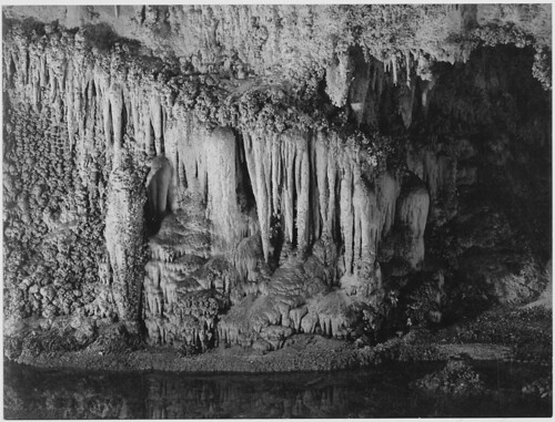
A view from inside one of the cliff dwellings in Bandelier. Located about ten feet above the cliff floor, these dwellings are surprisingly warm and cozy.
Over the course of the next few days, we visited many such dwellings: Chaco Canyon, a grand, multi-storied architectural structure built by ancient Pueblos in the ninth century; Navajo National Monument, a series of dwellings built into cliffs; and Canyon de Chelly, a labyrinth of several canyons with ancient ruins built within them. There are records indicating that Native people—Paleo-Indians, basket weavers, Pueblos, and eventually Navajos—have been living in these canyons for over 5000 years. While there is no written history of their lives, the many petroglyphs on the canyon walls tell us their stories.

Ricky amid the ruins of Chaco Canyon.
When the Pueblos eventually abandoned these dwellings (and settled in other areas in the southwest to become the Hopi people), the Navajo became the dominant tribe in the region. As we learned from the Navajo Museum we visited later in the tribal capital of Window Rock, after the U.S. displaced Mexico as the central governing power, the Diné—Navajo for “the people”—suffered greatly. Armies murdered people and burned homes, crops, and livestock. In 1864, soldiers marched the survivors of these raids 300 miles to a reserve in eastern New Mexico. The tribe was finally allowed to return to their home four years later, but the “Long Walk” still remains a tragic event in Navajo memory.

But even though Canyon de Chelly is administered by the National Parks Service, the canyons themselves are still home to the Navajos. This is clear from the fact that you can’t actually go down into the canyons without a guide. Unlike the other national parks we’ve visited, the ones in Navajo Nation don’t present videos telling you about the geology of the place; they tell you about its sacred significance, and use language like “ancient voices can be heard here.” As Ricky noted, places that are sacred to Native Americans are really the only places in America that are old enough to be considered holy at all. The parks on the reservation present more than ancient history; they present living history, too.

Visiting the parks, you feel not like a fellow citizen of the United States, but like a visitor to a foreign country. Stepping out of the car and onto the overlooks, there are Navajos there to greet you with a warm “Welcome to Canyon de Chelly. Is this your first time here?” And then they’ll often say, “Would you like to take a look at some of my artwork? I grew up right here inside the canyon.” You feel as if someone just placed lei over your head. You feel guilty because you know that they really need you to take a look at their artwork.

Unable to pay for a guide, Ricky looks down into Canyon de Chelly from above.
Doing my best to zoom into the ruins from the top of the canyon.

It was in Chinle, the “big city” outside Canyon de Chelly, in which we stayed at a free campground, where we first realized we were the only non-native people in the area. We bought groceries at Basha’s, “a Diné supermarket,” and went to have dinner at one of the few restaurant options, a pizza store. In both cases, we experienced the slight feeling of being undressed by many eyes. It wasn’t the stare of hostility or resentment, I don’t think. It was just the sudden awareness of outsiders in their presence.

During our stay in Chinle, we also visited Window Rock, Arizona, which is essentially the Washington, D.C. of Navajo Nation. I think the most surprising part of being on the reservation was not seeing the things you might expect, like poverty, but actually how similar—at least on the outside—their life is to that of most Americans. Families are picnicking in the park, teenagers are laughing over a Burger King milkshake, and mothers are shopping for groceries. The only difference is that the shopper, the cashier, and the guy parking his car next to you are all Navajo.

A Navajo park in Window Rock, AZ. 

I was fascinated by the little touches, like the logo for "women" on the restroom door, that signaled that we were no longer in mainstream America.

During our final night on the reservation, we stayed at Goulding’s—a campground next to Monument Valley, which is the the only major park in the area owned by the Navajos and not by the NPS. Goulding’s was opened by a couple of white settlers in the early 20s, who set up a trading post for the local Navajo population. With the onset of the Depression, however, the Gouldings suffered a financial blow. That is, until a Hollywood director, one John Ford, decided that the arid desert with its unique rock formations (hence the name “Monument Valley”) was the perfect location to shoot Stagecoach, a United Artist Western starring a baby-faced John Wayne. Although the campground is now entirely staffed by Navajos, it continues to attract visitors both to the campground and to Monument Valley through its association with John Wayne and Westerns more generally. When we arrived, we were delighted to learn that they would be showing Stagecoach that night—as they show a John Wayne movie every night.

What is ironic about Goulding’s, though, is that while the filming of these westerns helped to keep Monument Valley alive, as anyone who has seen a western knows, they also contribute to the negative/flattening portrayals of American Indians in film. Goulding’s helped Monument Valley thrive, but it also turned it into a tourist trap—something commercial rather than something sacred.  

The filming of Stagecoach in Monument Valley
Me at a very windy Monument Valley 
Interestingly enough, the Navajos at Monument Valley are well aware of this issue, as on one of the signs in the visitor’s center they mention the infractions of the “visitors to the region” and the ways in which they exploited Monument Valley’s resources. The truth of the matter is that Ricky and I hated Monument Valley. Not only did we have to pay $10 to enter the park (we enter National Parks for free because of our annual pass), but when we asked the man at the kiosk whether we would be able to explore the park in a two-wheel drive, he told us it’d be no problem. It turns out that it was. After warding off several people trying to get us to pay $120 for a guided horse tour, we only made it about a mile into the road, realizing that the car couldn’t sustain itself on the bumpy, unpaved road. As Ricky drove slowly, angrily back to the visitor’s center, he said he felt suddenly less interested in the book he had been reading about the Navajo.

Our inability to really make sense of the reservation—the presence of both normalcy and also a kind of third world feeling—helps to explain the paradoxes of the reservation system itself. As anyone who is a part of a religious or ethnic community knows, preservation and separation are virtually one and the same. If reservations are the means by which American Indians can continue to practice their ancient traditions, and in the case of the Navajo at least, live on their sacred lands, they are also the reason for poverty, unemployment, and general disconnect from the mainstream world.

I haven’t been able to do the kind of research I would like to in order to present more facts when writing about this highly complex topic. But with a little bit of Googling I was able to at least confirm something that Peter had told us: since the inception of the United States, there hasn’t been a single treaty between the U.S. and the natives that the U.S. hasn’t broken. Although policies have varied from extermination to “civilizing” missions, the ultimate goal is always the same; to force them to embrace European-American culture. Speaking to the Brothers of the Choctaw Nation in 1803, Thomas Jefferson said: “Compared with you, we are but as of yesterday in this land. Yet see how much more we have multiplied by industry, and the exercise of that reason which you possess in common with us. Follow then our example, brethren, and we will aid you with great pleasure” (Yale Law School). So, even a historically moderate attitude implied a complete disregard for the preservation of native culture.

With the growing population of American settlers, however, the policy quickly became even less understanding. Under Andrew Jackson, Congress passed the Indian Removal Act, authorizing the government to relocate southeastern Cherokees from their homes and forcefully move them to lands west of the Mississippi. Jackson used the military to transport them west on what became known as the “Trail of Tears.” Reservations, as these new lands were called, were generally located in places where they could be separated from tradition and more readily pushed into European-American society. After handing the cashier a $20 bill with the face of Andrew Jackson on it in that pizza store in Chinle, Ricky noted how bizarre that must be for them.

As more and more people came to the west—first the early settlers, then the tourists arriving on the transcontinental railroad, and later those travelling on Route 66 and the early US highway system, native culture was further forced to become something of a tourist attraction. Whether it was Westerns depicting Native Americans as wild and blood lusting, people going to the southwest to visit the famed trading posts, or youngsters taking “Indian Detours” during cross-country road trips, native culture seemed to appeal to the commercial mainstream as a result of its connotations of an “exotic” past. 

A prime example of this phenomenon lies in the Fred Harvey Company, named for an entrepreneurial freight agent, who began opening restaurants in the late 19th century in order to accommodate the growing number of travelers on the new Atchison, Topeka, and Santa Fe railways. Harvey also began to offer people the opportunity to go on "Indian Detours," bringing them into the areas that had previously been considered exclusively for natives. 


A 1920s billboard advertising an "Indian Detour."

We actually stopped at Petrified Forest National Park, in order to view an example of the Harvey Company's legacy. In addition to being home to a collection of logs that have turned into beautiful gemstones as a result of some geological process I don't really understand, the park is mostly famous for being the only national park that includes and protects a sizable portion of the old Route 66. Opened in 1940, the park also houses the Painted Desert Inn, a restaurant that was built by the Harvey Company to offer food, souvenirs, and lodging to these Route 66 travelers. Here, the famous "Harvey Girls" provided legendary service to the public, and helped to attract hordes to the otherwise desolate region.  

A photograph from the Painted Desert Inn during the 1940s
That's me at the Painted Desert Inn- now it's just a museum and visitor's center.
The growth of tourism in the area explains how the Navajo have both conceded to the assimilationist demands of the U.S. government, while still trying to hang on to their true selves as best as they could. 

Today, the legal standing of American Indians remains complex: there are over 500 federally-recognized tribal governments in the US, and these tribes possess the right to form their own governments, enforce laws within their lands, tax, and to zone and exclude people from tribal territories. But limitations on tribal powers are the same as those on states; they don’t have to power to make war, coin money, or engage in foreign relations. They also face the extra burden of trying to maintain a culture that the government has long tried to extinguish, and to live in a situation that is unfortunately conducive to poverty, unemployment, and lack of education.

These statistics were posted in the Monument Valley Visitor's Center.
While many improvements have been made—for example, tribal colleges have been founded on many of reservations, and in 2009, Obama signed a historic apology into law for past “ill-conceived policies”—the situation remains historically tragic and endlessly complex. Despite Obama’s claim that we are “one people, one America,” I have found that this really couldn’t be further from the truth.

Sunday, 25 March 2012

A Few Days in New Mexico

 Heading north from the Antelope Lodge in Alpine, our first stop was Fort Davis National Historic Site in Fort Davis, Texas. It was built in the 1850s to protect travelers along the road from San Antonio and El Paso from the ever-constant threat of Apache and Comanche attacks, and named after the man who was then the Secretary of War, Jefferson Davis. After the Civil War, it hosted “Buffalo Soldiers,” black troops charged with the task of eradicating the threat of Indian raids from the American West. It was abandoned and partially dismantled in the early 1890s, once the Indian threat was neutralized—through their near-eradication and total defeat—and the advent of the railroad made the El Paso Road, and military protection of it, obsolete.

The troops at Fort Davis were charged with protecting travel along the El Paso Road, including postal deliveries.
Fascinating stuff, no doubt. But our real reason for stopping at Fort Davis was what we have come to call a “cancellation stamp opportunity.”

At the Martin Luther King National Historic Site in Atlanta, a National Parks ranger gave us the hardest of hard sells to purchase, for $8.95, a National Parks Passport. He said that he only had a few 25th anniversary editions of the passport left, and that once they sold out they’d be gone for good. Ordinarily, Brahna and I would both be pretty opposed to what seemed like such a trite, juvenile souvenir, but since the ranger said it would be a shame for us to cross the country without the passport, and with such a low price, we decided to go for it.

The passport is about the size of a small reporter’s notebook. It’s divided into regions of the country—Southeast, Southwest, Western Region, etc. When you get to a National Park, National Historic Site, or National Monument, there is a small counter in the corner, which we’d never noticed before, with a few stamps, a stamp pad, and some spare sheets of paper to practice on. Each park has its own “cancellation stamp,” a term referring to the stamps post offices place on your envelope indicating where it has entered the system. The National Parks Service apparently started offering these stamps in 1986, and, according to every ranger we meet, the program has ignited a passionate fervor within a certain very small portion of the populace ever since. Brahna and I are proud to be among those special, special few.

Our passport, with some hard-earned cancellation stamps from the Southwest.
One benefit of the passport is that it often convinces us to go out of our way to get a stamp. Such a decision inevitably leads us to places that we previously knew very little about, like the Jean Lafitte National Monument in Louisiana (Cajun history and culture); the San Antonio Missions (Spanish proselytization to natives); and Fort Davis. The passport gives us a tiny extra incentive to visit places we otherwise would miss, and thus adds to what Brahna has dryly commented is already a pretty rigorous curriculum.

After Fort Davis we stopped at Balmorhea State Park, just south of the New Mexico border, which is the location of a massive pool—25 feet deep in some places—built by the Civilian Conservation Corps in the 1930s around a natural mineral spring. Brahna and I laid out a blanket and enjoyed a pleasant picnic of leftovers before hopping in the pool. Thousands of tiny snowballs floated down from the park’s cottonwood trees, giving the scene a bit of a surreal air.

Fortunately, my memory of that pleasant afternoon was not completely marred by the diagnosis, a few days later, of a doctor in Albuquerque, basically to the effect that the small, red hives-like rashes that appeared all over my body were caused by “hot tub folliculitis,” a non-lethal, merely itchy, condition caused by bacteria often found in hot tubs or mineral springs. Rashes, topical Benedryl, and antibiotics are temporary, but memories are forever.

After crossing into New Mexico and spending the night at a private campground, we headed south toward Carlsbad Caverns National Park, which encompasses an unfathomably large system of caves under the foothills of the Guadalupe Mountains. The only cave actually named Carlsbad Cavern is the one most often visited by tourists, and whose most prominent feature is the Big Room, the floor space of which is the size of about six football fields.

The most amazing thing about the caverns, though, when you consider the size of the cave you do see, is just how much of the caverns is not available for viewing. Just three caves are open to the general public. An additional seven can be accessed by your more serious cavers and official, park-endorsed expeditions. If I recall correctly, there are about 80 distinct caves in the whole Carlsbad system, most of which have never been explored by human beings. Only relatively recently, researchers felt wind blowing out of a tunnel off Carlsbad Cavern, and decided to investigate. They uncovered a cave so large it makes Carlsbad look like one of the tunnels my father and I used to dig at the beach. The Parks Service has no plans to open it to the public. 
 
Rightfully so. Ansel Adams, who photographed Carlsbad in the 1930s (though he disliked those photographs, due to the need for artificial light in the completely dark caves), called the caverns “something that should not exist in relation to human beings. Something as remote as the galaxy, as incomprehensible as a nightmare and beautiful in spite of everything.” The bizarre formations of Carlsbad Caverns—to rehearse it once again: stalagmites from the ground, stalactites from the ceiling—are indeed beautiful, but it is strange to admire the beauty of something that, one could argue, ought to have never really been seen.

One of Ansel Adams' photographs he did at Carlsbad for the U.S. government.
 From Carlsbad we drove into the Sacramento Mountains and passed through the tiny town of Cloudcroft, which I heard described as America’s highest town (in elevation) at about 7,000 feet, though I think there’s reason to doubt that. Our destination was a small campground in what we found out was a ridiculously obscure corner of the Lincoln National Forest. As the sun set we raced around turns of a scenic byway (promising we’d linger to enjoy the views in the morning), down a long dirt road and into the empty parking lot. That the campground was one of the national forest’s few year-round camping options should have warned us that it could be completely covered in snow. Besides that, the air was dangerously cold.

Mortimer at Lincoln National Forest.
Sorry to give up what seemed like the most isolated campsite in America, we raced back down the scenic byway and out of the mountains towards the town of Alamogordo, trying to beat the clock as the only food option in town told us over the phone they’d be closing soon due to a shortage of food. By the time we finished the meal, around 9:30 pm, we still didn’t know where we were spending the night, which is, for good and for bad, always a rush. We ended up finding out that the campground in town was much cheaper than the price listed in our AAA camping book, and called it a night.

The next morning we drove to White Sands National Monument. It comprises a few hundred square miles of pristine white sand dunes, formed from gypsum swept by rain down from the surrounding mountains into a basin, and then chopped into grain-size pieces by the valley’s fierce wind. It is geologically interesting, and it is beautiful, but more than anything else White Sands is just plain fun. Brahna and I treated it like a massive playground—struggling up the dunes and running back down. Doing so doesn’t hurt the dunes at all, since they tend to move a few feet every year anyway, and the supply of gypsum from the mountains is essentially unlimited. Our morning at White Sands was the most plain fun I’ve had so far on the trip.

A concession stand at the park sells sleds for something around $10, but we found a broken one in the garbage and broke it some more.
As we left White Sands and drove north towards Albuquerque, we passed the Trinity test site, where the world’s first atomic bomb was exploded. To skip ahead a little bit, we later also visited Los Alamos, where the bomb was invented and designed, thus rounding out the “nuclear weapons” portion of our Southwest education. The Bradbury Science Museum in Los Alamos was an especially interesting and accessible museum on what is a pretty uninteresting and inaccessible subject for both Brahna and me—science. It also had something I’ve never seen in a museum before: one corner was set aside as a “public forum,” where public advocacy groups present, with varying degrees of English fluency and command of basic logic, their own parochial opinions on important questions covered (or, in their opinion, not covered) by the museum itself. Topics like the viability of nuclear energy and the necessity of dropping Little Boy on Hiroshima drew particularly heated curatorial debate.

Our first stop in Albuquerque was the home of Ernie Pyle—now a branch of the Albuquerque public library—whose name the older readers of this blog might recognize as that of a famous war reporter who died in the Pacific theatre in 1945. They’d be right, but it was not the house of Ernie Pyle, 1940s war reporter, that I wanted to see, but that of Ernie Pyle, roving 1930s newspaper columnist, that I’d been looking forward to, and talking Brahna’s ear off about, since we left New Jersey. Since finding, in an Amherst bookstore, “Ernie’s America: The Best of Ernie Pyle’s 1930s Travel Dispatches,” I’ve become a bit obsessed with Pyle, and what he got and what he missed in writing about America.

At the Ernie Pyle House and Library in Albuquerque.
 I really wanted to write a long post about my discovery of Pyle and my reading of his American travel pieces, but, seeing as life on the road isn’t exactly conducive to strenuous thought and diligent writing—and this is quite ironic, when it comes to talking about Ernie Pyle—I’ll have to save that more intensive meditation for somewhere else and present here what thoughts I can.

Sometime in the early years of the Great Depression, Ernie Pyle’s editors at the Scripps Howard newspaper chain handed him a dream job. They would pay him to travel around the country full-time, and he would have the liberty to write about anything he damn well pleased. That was the set-up, no strings attached. Pyle was responsible for six columns every week, which is, of course, completely nuts.

Pyle’s columns were famous, at the time, for their down-home folksiness and for their author’s willingness and courage to let his subjects tell their own stories. Pyle is so different from other cross-country road trip authors—Kerouac and Henry Miller, especially—in that the story, for him, is always about America and Americans, and almost never about himself. Pyle would roll into town and just look for interesting characters to write about: he’d check with the local paper, the police department, the bartenders. Then he’d drive out to meet them. His columns, when read in bulk, form a more complex and variegated picture of America during the Great Depression than any other work I’ve seen.

I’ll end this now, since I could really go on for quite awhile about Ernie Pyle. Now that I’ve at least introduced him, though, I’ll try to use Pyle and his writings as a counter-point as we continue our journey west, then north, and finally back east. I’ve been mostly reading his columns on a state-by-state basis, as we pass through them. His reflections on places like New Orleans or Carlsbad, or on traveling in America more generally, hold up after nearly 80 years, and are often better for their age.

"I have no home. My home is where my extra luggage is, and where the car is stored, and where I happen to be getting mail this time. My home is America."

Monday, 19 March 2012

Backcountry Camping in Big Bend

Shortly before we left for this trip, Brahna and I went to Campmor in Paramus, New Jersey, and bought tons of new camping equipment. Our faith in the tent we’d used all last summer was diminished by the pummeling it took in an Irene-related storm on an island off Maryland at the end of August. Returning from dinner on the mainland, we found the tent flooded in almost a foot of water and flipped over by the wind. It was saved from being blown into the ocean only by the 15 pound dumbbell I’d placed in it before we left—the most action that weight has seen in awhile, I’m sure. Our sleeping bags were soaked through, forcing us to spend most of the next day in a laundromat in Ocean City. (Those bulky things date from at least the mid ‘80s, and, according to my father, had never previously been washed.) We really didn’t want a recurrence of that on this trip, the length of which seemed to make any new purchase of equipment a good investment. To that end, we bought a new tent and new sleeping bags: small, compact, and lightweight—perfect for an overnight backpacking expedition.

Driving west from Amistad toward Big Bend, the towns are small and rare. We did stop by the Pecos River, right above its junction with the Rio Grande. The river here carves out a massive canyon, which I remembered taking pictures of a few years ago when I first took the train across the country by myself. Stopping at the Pecos this time was important to me, because it was one of many places which I had passed before, from the distance of a speeding train, and vowed that one day I shall really return.

The Pecos River seen from the Sunset Limited, July 2009.


The Pecos River seen from a bit closer up, March 2012.
We filled up on groceries and gasoline in the towns of Sanderson and Marathon, about 100 miles north of Big Bend, because supplies are supposed to be limited in the park itself. The drive down from Marathon was absolutely gorgeous. As you enter the park itself, still far from the Visitor’s Center, the fencing along the roadside fades away and there’s nothing between you and the desert and the mountains.

The two important things about Big Bend are its remoteness and its immensity. At about 1,000 square miles and 100 miles from the nearest town, Big Bend is one of the least visited parks in the country, and perhaps the one where each visitor has to himself the most room. Thus, we were  a bit surprised to find, after arriving at the visitor’s center, that not only was every campground in the park completely booked, but so too was every roadside primitive site and every backcountry site up in the mountains. Our only option for sleeping in the park was walking out into the desert and pitching our tent wherever we could find a spot between the cacti and the yucca plants—so long as we were out of sight of any roads. We decided we weren’t quite ready for that at the moment, and opted to spend the night at one of the private campgrounds just outside the park. We did, however, secure a backcountry permit for the next night, at a site about two miles into the Chisos Mountains, a nuclear cluster of mountains in the middle of the brutally hot desert.

The Chisos Mountains in Big Bend.
 As we broke down camp the next morning—the “developed” private campground turned out to be rather primitive itself—I filled my large new pack with the sleeping bags, the sleeping pads, and the tent, and Brahna packed a backpack full of clothing, books, flashlights, and food. We drove the 30 miles back into the park and up into the Chisos Basin, a massive bowl surrounded by mountains. I parked Morty about a mile away from the visitor’s center, and hiked back up to where Brahna waited with the backpacks. We bought a map of the Chisos, filled our several water containers, and—excited, nervous, a bit surprised at what we were doing—headed to the trailhead and started climbing up.

At the bottom of the trail.
We are both horribly out of shape. Besides not being used to hiking with such heavy loads, neither Brahna nor I have done too much hiking in the past year. Moreover, the Eastern portion of our trip focused more on history than nature, and was meant more to put miles between us and home than anything else. Long, long stretches in the car every single day for the past month, plus a nutritionally unreliable travel diet, made us feel the pain those first few miles. Finally, though, we climbed a last steep incline and emerged onto the Juniper Flats area, where our campsite was located down a small path leading away from and nearly out of sight of the trail. The sun was by this point, around 11 a.m., already baking our faces, the air, and the ground, so we pitched the tent in a spot that we figured would have the most shade throughout the day. It was also conveniently located the furthest possible distance from the aluminum bear boxes where we’d store our food and our packs. Just in case.

For some reason, the flies in the mountains were fiendish, attacking us in swarms. Though we wanted to rest in our tent in the shade for awhile, the flies followed us in and ultimately forced us out. We packed the small backpack full of water and sandwiches and headed up the trail. After a short lunch break not too far away, and an unfortunate, if predictable, U-turn back to the tent for my hat, we were on our way.

After the Juniper Flats, the trail climbs quickly up the side of the mountain, mostly through dozens upon dozens of switchbacks. After every couple turns, we’d look back at the Basin and try to convince ourselves we were making some progress. “Really getting up there,” I said to Brahna, maybe 20 times, until it almost seemed true.
 
The Chisos Basin, from the mountains.

Our goal was the summit of Emory Peak, the highest point in Big Bend at about 7,900 feet. Most people on the trail—who, like most people you meet on hiking trails, were extraordinarily nice and jovial and empathetic—were either going to or returning from the peak. We established something like a friendship with a couple from Houston, a clownish ex-marine and his equally amusing girlfriend, who we kept passing and getting passed by as we all struggled up the trail. We found them again just below the summit, a 30-foot pinnacle of boulders at the top of which were solar panels, a radio tower, and three scary ravens. Brahna stayed below with the couple. “Discretion is the better part of valor,” said the ex-marine.


At the summit of Emory Peak.


With legs feeling like jelly, around four miles back to the campsite, and the sun beginning to set, Brahna and I started to book it down from the summit, greeting remembered landmarks like old friends—a debarked tree, the site of a bathroom break, where we had lunch. As usual, going down was at least as difficult as going up, much worse on the knees, and without even that sense of mission which accompanies the ascent.

By the time we got back to the campsite, we were sweaty, exhausted, thirsty, and, at least in the case of your ever-humble correspondent, impossibly smelly. I felt tortured by the Houston couple’s casual comment that they were getting “hot pizza” once they made it back down—the “hot,” in particular, seemed pointed, cruel, and unnecessary—and, with all due respect to the chef, not exactly compensated by the thought of the cold leftovers from the massive batch of rice and beans Brahna had made the night before, which were waiting for us in the bear box. With only a mile or two between us and Mortimer, and after such a long, sweaty, arduous day, it hardly seemed worthwhile to stop and sleep in our own grime and filth, with the amount of flies already in our tent surpassed only by the swarm of hundreds buzzing just outside the netting, aching to get in. We ate our rice and beans quickly while sitting cross-legged on the bear box. The dark came on very quickly, as Brahna has noted it always seems to do out here in the West. There seems to be a burn ban everywhere in the Southwest these days, so, without the comfort and light of a fire, we retired—sticky, smelly, unhappy—to the tent, read a little, and slept. Or, tried to sleep.

***
 
One of the things I’ve been most looking forward to about this trip is the opportunity to visit National Parks and actually see and do them my own way. While I’m immensely grateful to my parents for having brought me to so many parks when I was younger—Death Valley, Yellowstone, the Badlands, and, more recently, Denali and Sequoia—and for having instilled in me a general appreciation for them, I’ve often been frustrated by the inability to go on more extended and adventurous hikes. I remember looking longingly at the bearded hikers obligatorily watching backcountry camping videos at Denali, before they headed off into the Alaskan wilderness. Meanwhile, my family would hop on the ranger-led tour bus, where we aimed our cameras out the window at grizzly bears eating grass on the roadside—which, of course, was itself pretty cool, but I wanted to be closer to the action.
 
Brahna, burrowed deep inside her bag, was the first to fall asleep. I stayed awake, reading Walt Whitman and holding my breath with every sound I heard, in order to ascertain its source and potential for danger. The great irony of my insistence that we do some backcountry camping on this trip is that often in the middle of the night I suddenly become convinced that someone or something is behind every tree, waiting so patiently to strike. “We’re not alone,” I whispered to Brahna, very late one night while we were camping in an undeveloped (read: unsecured) site off the Natchez Trace Parkway in Mississippi. “There’s something in the trees.” Understandably, she hates this, because I’m always the one pushing for camping in the wilderness. Nonetheless, I can be a huge baby in the middle of a wild forest late a night.

To put what, at the time, felt like a very, very long story short, I barely slept that night. My concerns fell into two equally menacing categories: mountain lions and bears. When I had reasoned myself out of fear of the one, I would simply focus my attentions on the other. This cycle repeated itself into the early hours of the morning, when I finally somehow fell asleep. I was grateful, maybe even a little surprised, to open my eyes the next morning and to see my clearly innocuous, even peaceful, surroundings illuminated by the newly risen sun.

***
 
After an extremely sore valedictory hike back down to the parking lot, Brahna and I decided we wouldn’t stay for a third night in Big Bend, even though our backcountry permit also reserved for us a car-side spot elsewhere in the park. We—I—needed a shower badly, but we also needed a bed, homemade food, and an escape from the sun. Still suffering in our dirty clothes from the day before, we sped out of Big Bend along a different road than the one we took on the way in: State Route 118. The New York Times calls it “a portal to another dimension,” and it was, and we needed it to be.
That afternoon we checked into the Antelope Lodge in Alpine, Texas, a renovated old motor "court" from the 1940s. Despite its disagreeable proprietress, it came the closest of all the motels we’ve stayed at so far to the motor camp from It Happened One Night. We showered, did laundry, cooked, read, and just generally came back to life. By the time we left late the next morning, Big Bend felt more than just 100 miles away.

Soon we’ll write about Carlsbad Caverns and White Sands, in southern New Mexico. Right now we’re in Santa Fe.

Thursday, 15 March 2012

Texas Rain (and Texas Heat)

Although Texas has been suffering from the worst drought in its history, our first few days in the Lone Star State could not have been wetter.

After leaving Cajun country, we entered the state of Texas, with Houston as our first stop. Our plan was to take another stab at couchsurfing. This time, the suspect was Josue, a thirty-something Mexican-American with two kids, who one couchsurfer dubbed “the couchsurfing king of Houston.” Grateful to be staying with the couchsurfing king of Houston, we were willing to bide our time until 9 pm, when he would be returning with the kids from soccer practice.

The only problem was that it was pouring rain. We took a brief walking tour of historic Houston, but after deciding that we were too wet and Houston wasn’t interesting enough, we moved on to a café, where we waited out the rest of the day. There were unfortunately no awake kids to play with by the time we finally got to Josue’s, but he turned out to be extremely nice and welcoming as he gave us not simply a couch, but an entire room.

Me in Allen's Landing Park in Houston. As you can see, it wasn't very exciting.

The next day was a bit of a doozy. Although we planned to spend at least three days in Austin, we discovered that our timing was not so fortuitous as the upcoming weekend was South by Southwest (SXSW), one of the largest music/film festivals in North America. Desperate to find a place to stay, we tried our hand at a new informal sleeping arrangement for travelers called airbnb. It’s kind of like couchsurfing, except that you pay the person to stay at their house instead of staying there for free.

After arriving at Mo’s, our airbnb host in Austin (we took a short interlude at the Lyndon Baines Johnson library and museum right outside the city), we determined that a much-needed catnap was preferable to venturing into the pouring rain once again.

But as we were forced to whittle our stay in Austin down to one night—it was utterly impossible to find a place to stay over the weekend (even America’s Best Value Inn was charging 200$ a night!!) —we determined that we wouldn’t let the rain bog us down. We were going to go out and that was the end of it.

At first, we ventured onto 6th street, the more commercial downtown thoroughfare, known for its many live music venues. But after facing too many college students in proper nightlife attire, we determined that we needed a greater incentive to fight off the rain and our increasing exhaustion.

And find it we did at the Broken Spoke, a good ol’ Texas Honky-tonk, recommended to us by our hostess. Suddenly, we entered a room with cheap beer, an awesome country-western band, and several couples two-stepping along the dance floor. Far from the world of college kids who looked like they could have been from anywhere, we found ourselves amid veritable cowboys—hats, belts, and all. (I took an awesome video of this event, but unfortunately, the internet is not allowing me to upload it, so I'll have to resort to a youtube clip of a different band playing at the Broken Spoke.)

Riding the high of the Broken Spoke, the next morning we decided  that we would continue to do Austin as best as we could, despite the continual downpour. We began at the Alamo Drafthouse, an ingenious movie house that offers wait service in the theatre. In lieu of having no other choices, we ended up seeing The Artist, which may have recently won an Oscar, but I found to be so-so. The novelty really lay in the eating of a large salad served to me in the theater. 

That night, we booked it, in the rain of course, to any motel we could find in San Antonio—our next destination. We fell upon the Sands Motel, which seemed to fit our general criteria of cheap and dingy just fine.

But we didn’t know just how cheap and dingy it was until the next morning. About forty minutes after arriving in downtown San Antonio, Ricky realized that he didn’t have his wallet. Full disclosure to the reader: Ricky is a chronic forgetter and loser-of-things, so I wasn’t exactly sure what to make of his assertion.

He said that he was sure he left in his jacket, which was still hanging in the motel room closet.
When we got back to the motel, we went promptly to the hotel manager, a soft-spoken Indian man (the actual kind), and asked him if we could go back into the hotel room to look for the jacket. He told us that the room had been cleaned already, so we would have to ask Angie, the hotel maid. As Ricky approached Angie, a heavy-set Native American woman, I went back to the car to furiously check for the wallet in the hopes that we would not have to face what seemed liked the inevitable.

“Angie said that she found the jacket, but there was no wallet in it,” Ricky quickly told me. We looked at each other knowingly: it was the maid. But how do we get her to confess? Ricky found the only route to do so; by telling her that we were going to have to call the police if she didn’t “find” it. She promptly said that she would keep “looking.” Meanwhile, the hotel manager was begging us not to take any action, since it would reflect poorly on his hotel. And all the while, my cultural studies background was giving me a difficult time of making sense of this situation. A white guy asking for his wallet. A recent immigrant begging him not to compromise his business. And a native woman who, likely not of an enviable monetary situation, took it.

But regardless of whose fault it was—Ricky’s for leaving the wallet, the maid’s for stealing it, or the manager’s for looking the other way—the future of our trip was hanging on the retrieval of that wallet, which contained a lot of cash, credit cards, and his driver’s license. A few heart-thumping minutes later, Angie emerged from the storeroom suddenly victorious in her search.

A bit frazzled, we finally returned to the downtown area in the hardest rain yet, where we walked the San Antonio River Walk, visited The Alamo, and saw some of the surviving missions, where Spanish settlers attempted to convert the native population.

Me on the River Walk. 

Ricky in front of The Alamo.
While I knew about Texas and its complicated legacy of the Wild West, East Texas, particularly in the pouring rain, failed to bring the state’s unique story to life. But on that drive from San Antonio to the Amistad Recreation Area—where we would be camping that night en route to Big Bend National Park—I suddenly noticed a horizontal line in the sky where the dark clouds ended and the clear sky began. .


The line in the sky dividing the rain from the sun. 
Our drive into the Amistad National Recreation Area.
It was as if we had reached a gateway, and when we finally drove through it, we had emerged in the arid, desolate landscape of the desert. After a month of venturing through the South, we had officially entered the West.


Last week’s adventures in Amistad and Big Bend did not provide us with any internet access, so next up, Ricky will debrief our adventures in the South Texan desert.  

Sunday, 11 March 2012

Where We Are Now: Seminole Canyon State Historical Park

While Brahna finishes using this park's showers--our site at the nearby Amistad National Recreation Area offers no such conveniences--I figured I'd use the free Wi-Fi here to put up at least a picture from where we are right now, before she writes a more thorough post about our time in Texas so far.

The canyon we toured today is host to some of the oldest cave drawings, or pictographs, in the Americas. They are painted with a variety of colors and are mostly unintelligible. The figures with a multitude of different animal parts--wings, a bear's head, antlers--are supposedly the product of peyote- and mescalin-infused visions and dreams.

The painting in the photograph below may be of some kind of ceremony. From the central figure, around which the others are encircled, flows a wavy line that our tour guide suggested may indicate some sort of travel, either into or out of the spirit world. The drawings are about 4,000 years old.

Saturday, 10 March 2012

The Mississippi Delta, New Orleans, and Cajun Country


Despite the underwhelming Delta Blues Museum in Clarksdale and our ambiguously anti-Semitic encounter outside its doors, it was very cool to be in the Delta region. Leaving Clarksdale, we passed the Riverside Motel, where Bessie Smith died, and the notorious “crossroads” where Robert Johnson supposedly sold his soul to the devil. Driving down the famous Highway 61, we eyed the gathering storm clouds nervously, and somewhat frantically listened to tornado warnings on the radio. The darkest clouds on the horizon were to the south and west, and so were the names of the counties mentioned on the radio, and so was our destination, Greenwood—where Robert Johnson died, and supposedly (always supposedly) was buried.

Greenwood, Mississippi.
 After rushing through the storm and staying the night in a little town called Belzoni, we tried and failed to find an apparently now-closed museum about Casey Jones, the famous train conductor. A bit frustrated, we decided to hop on the Interstate and book it for Jackson. Ever topical, we put on Johnny Cash, live at Folsom Prison. I promptly got a speeding ticket for going 87 in a 70 mph zone.

We didn’t spend too much time in either Jackson or Vicksburg, where we did enjoy a nice picnic on a bluff over the Mississippi. We met a nice gentleman there who grew up in the vicinity and claimed the river was in his blood. He said he proposed to his wife some 50 years ago in the parking spot next to Mortimer. He pointed out to us some of the spots relevant to the 1863 Grant campaign. When we told him what we’d already done in Mississippi and what we planned to do, he said we were “on the right track.” As someone who chronically worries that whatever route he is taking is not the most authentic route, this was nice to here.

We camped that night at a free campground off the Natchez Trace Parkway, a scenic byway that runs several hundred miles from Natchez to Nashville, roughly along the route of old Native American trails. Built, like most good things in this country, in the 1930s, the Trace is certainly one of the best drives in the country for its combination of historical importance with unadulterated natural beauty: its entire length is completely free of power lines, billboards, or any commercialism whatsoever. Driving any portion of it is a privilege, and it feels like one.

Natchez Trace Parkway.
The next morning we toured two portions of the Natchez National Historical Park: the first was the Melrose Estate, just a basic old plantation, while the second was a house in the city that once belonged to William Johnson, a black freedman who, interestingly, eventually went on to be a successful businessman himself, owning most of the prominent barbershops in town and even several slaves. We learned that this was not so rare as you might think: if I remember correctly, about 12% of free blacks in the South before the Civil War owned slaves.
 
Later, on the drive down through plantation country in Louisiana towards New Orleans, we visited the Oakley Plantation, where a young John James Audobon tutored the mistress of the estate, and painted the first 30 of his Birds of America series. The grounds were beautiful and the tour was interesting, but Brahna and I were slightly taken aback when the tour guide, an inoffensive character in himself, proclaimed: “We actually treat our slaves quite well here at Oakley. We allow them to own cattle and even some land.” While I always find creepy the way that historians, professional and amateur, speak of things past in the present tense (i.e. “Grant needs Vicksburg to open up the Mississippi and cut the Confederacy in two…”), hearing the tour guide speak in such a manner about slavery, as if, even if only colloquially, owning for himself that moral abomination, was more than a little weird. It led me to question the entire pastime—and that’s what it is in the South—of visiting old plantations and lamenting, implicitly, their bygone glory. As Brahna noted, the basic narrative is something like this: “Life in the Old South was easy, breezy, and rich, and here’s this beautiful house, and, oh yeah, here’s the slave quarters.” The connection between the leisurely lives of the plantation owners, memorialization of which is always the raison d’etre of the museums, and the existence of slavery is almost never directly and explicitly drawn. I started to feel as if just visiting these places means being complicit with an entire historical narrative with which I am deeply uncomfortable. While this is surely an exaggeration, the discomfort is real, and one faces it everywhere on a journey through the South.

Only in the South.
This was my fourth time in New Orleans, but my first since achieving sovereignty over my wallet. Thus I was mildly surprised to find, in place of the moneyless paradise of my memory, a city, and especially a French Quarter, overrun with $4 croissants and a Café du Monde line stretching the whole width of Jackson Square. While on the previous trips—a train trip with my father and two high school Katrina-related spring breaks—I had relied directly or indirectly on my parents’ funds, this time I was forced to be more budgeted. Suddenly, the city seemed less “eclectic” or “unique,” or any of the other words I had used for years to evangelize for New Orleans, and the Quarter itself much less “quaint” or “grungy.” This time, New Orleans represented itself to me as more similar than not to so many other cities I’ve visited—Portland, Denver, San Francisco, Austin—and not quite the non-commercialized weirdos’ haven I had held it to be. It was a little sad to realize that my idealization of New Orleans was more the effect of youth and inexperience than any radical differentness intrinsic to the city itself.

The St. Louis Cathedral from the Algiers ferry.
It didn’t take long to get over this realization, and to begin to enjoy New Orleans for what it actually is: a major modern city that does indeed have a certain unique spirit to it, and one that has made immeasurable progress recovering from a massive natural and manmade disaster, the reminders of which were still evident on every block when I last visited about four years ago. Gone were the water lines on buildings showing where the flood reached and remained for weeks after the levees failed. Gone, too, the boards on Canal Street shops and, for the most part, the windowless, hollowed-out high-rises around downtown. And though the difference between the investment in downtown and the Ninth Ward remains insultingly obvious, even that neighborhood—a ghost town just four years ago—shows serious improvement: most of the buildings now seem livable at least, and life has returned to its still dilapidated and potholed streets.

We stayed with Noa, a friend of one of Brahna’s sisters, whose house uptown gave us a really comfortable and welcoming base of operations for both exploring the city and getting some much needed R&R. Our first full day in the city we did the requisite AAA walking tour of the French Quarter, catnapped in Audobon Park, and tried some local delicacies at a street festival. This was also when we drove around to find what was left of hurricane damage at two places I remembered seeing some particularly brutal devastation: on the Lake Ponchartrain waterfront and in the Ninth Ward.
We took the next day pretty easy, as we were starting to feel the very real brunt of such persistent travel, and maybe a little of what my father calls “vista fatigue.” We combatted this with a very slow morning on Noa’s sunny back porch: Brahna wrote her last blog post and I read A Confederacy of Dunces (my reading habits while traveling are pathetically topical). Later, we did the AAA walking tour of the Garden District, took the ferry over to Algiers and back again, and then caught some live jazz on Frenchman Street. Tipsy and tired and in no mood to endure the long trek via streetcar back uptown, we nonetheless convinced ourselves to dip in for the obligatory Café du Monde beignets and café au lait. It was kind of pointless.

Cafe du Monde.
We left New Orleans the next morning and headed for Lake Fause Pointe State Park, in the heart of Cajun Country. We pitched our tent in a picture-perfect spot on the banks of a bayou, and finally got the chance to open up our new double hammock and really unwind. We had had no food all day, however, so we headed into the nearest town (almost 20 miles away) for groceries, gas, and firewood. A man working at the gas station (which had pumps dating at least from the 1950s) directed us down a few country roads to a private house where he said we could knock on the door for firewood.

It was outside this house that we met Gerald Judice, an amazingly kind Cajun man who has made it his job to haul massive chunks of ancient cypress wood out of the local bayous, dry it out for about five years, and shape it into bowls, paddles, chairs, and anything else he cares to. He gave us a tour of his wood findings and his creations, and showed us around his orange orchard, picking off samples from every tree for us to try. Gerald sent us home with a shopping bag full of various kinds of oranges, which we are still trying to get through. As Brahna said later, of Gerald and so many others like him that we’ve met, their kindness is truly humbling.

The next morning we rented a canoe for $5 and explored some of the bayous surrounding the park. Our constant vigilance for alligators turned up only a few babies and many turtles, until, crossing paths again with two old ladies fishing off a dock (we’d gotten tangled in their lines the first time around), they pointed to an adult gator nosing through the water. 

Bayou Benoit near St. Martinsville, Louisiana.
This post is already way too long, but I also want to mention Ian and Sue, a couple we met at the campground. They are a middle-aged couple from Vermont who have taken six months off to travel around the South by RV. As they have both more time and less ground to cover than we do, Ian and Sue have been able to go much slower: they, too, had traveled around 4,000 miles since leaving the Northeast, but they left just after Christmas. Ian said that they had learned the lesson long ago that by trying to see too much, you end up seeing very little. 

I appreciated the wisdom of this, and began to feel bad about all the up-and-down movement Brahna and I had submitted ourselves to on this first leg of the trip. I began to feel tired, or finally realized I was tired, of putting up the tent one night only to take it down the next morning. While obviously you always have to makes compromises—on a trip like this, choosing to see something is always an implicit choice not to see something else—I began to worry, as I’m always wont to do, that we weren’t doing the trip right. Maybe two nights in one place is better than two nights in two different places. Maybe we’re being too ambitious. Maybe we’ll have regrets.

We both realize that these things are always held in a fine balance, and that the important thing is not to be fearful that we’re doing it wrong. Nonetheless, I’m excited as we head into the West. With so much more space between what is so appropriately called “attractions,” I think this next leg of the trip will be something else entirely.

***

Next up: Houston, Austin, San Antonio. Tonight we’re camping at the Amistad reservoir, which straddles the Mexican-American border.